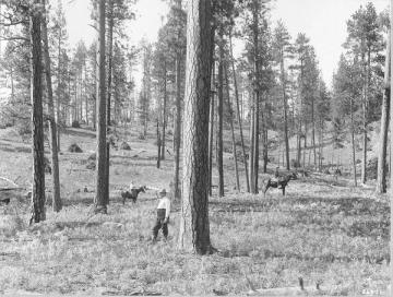
The Lick Creek Demonstration/Research Forest (Lick Creek) is located on the Darby Ranger District of the Bitterroot National Forest (BNF) in western Montana. Although the area's management and research activities go back to 1906, the Lick Creek was only officially established in 1991 when the Intermountain Research Station and the BNF entered into a formal agreement of cooperation on innovative management and multiple use methods for various resource outputs. Lick Creek is home to the longest running fuel treatment and restoration study in the western United States, including a photoseries dating back to those original 1906 harvests.
The elevation range of Lick Creek is 1300 to 1500 m with south-facing slopes of 0–30% and shallow to moderately deep soils classified as Elkner Gravelly Loam, coarse-loamy, mixed, frigid, Typic Cryochrepts originating from granitic parent materials. The climate is characterized by generally dry summers, between 27 and 50% of the average 400mm of precipitation falls as snow during the winter with most of the remaining precipitation falling in the spring and fall. The mean annual temperature is 7 ◦C.
Climax forest types include Douglas-fir (Pseudotsuga menziesii) on dry sites and grand fir (Abies grandis) on moist sites at the lower elevations. Subalpine fir (A. lasiocarpa) is common at the higher elevations. Seral species common after disturbances include ponderosa pine (Pinus ponderosa) on dry, low-elevation sites and lodgepole pine (P. contorta) and Douglas-fir on wetter and higher elevation sites.
Documents
- Native and non-native understory vegetation responses to restoration treatments in a dry conifer forest over 23 years
- Seeing the Big Picture: Long Term Studies at Lick Creek Demonstrate How Fuel Treatments Impact a Changing Forest
- Lick Creek: Lessons learned after 20+ years of fuel treatments in Ponderosa pine
- Forest restoration treatments in a ponderosa pine forest enhance physiological activity and growth under climatic stress
- Fuel treatment longevity in ponderosa pine-dominated forest 24 years after cutting and prescribed burning
- Lick Creek Demonstration-Research Forest: 25-Year Fire and Cutting Effects on Vegetation & Fuels
- Long-term effects of fuel treatments on aboveground biomass accumulation in ponderosa pine forests of the northern Rocky Mountains
- Experimental forests and climate change: views of long-term employees on ecological change and the role of Experimental Forests and Ranges in understanding and adapting to climate change
- Reproductive output of ponderosa pine in response to thinning and prescribed burning in western Montana
- Ten-year responses of ponderosa pine growth, vigor, and recruitment to restoration treatments in the Bitterroot Mountains, Montana, USA
- Physiological response of ponderosa pine in western Montana to thinning, prescribed fire, and burning season
- Influence of fire on native nitrogen-fixing plants and soil nitrogen status in ponderosa pine-Douglas-fir forests in western Montana
- Effects of selection harvest and prescribed fire on the soil nitrogen status of ponderosa pine forests
- 80 years of change in a ponderosa pine forest
- Antelope bitterbrush and Scouler's willow response to a shelterwood harvest and prescribed burn in western Montana
- Restoring fire-dependent ponderosa pine forests in western Montana
- A summary of ponderosa pine (Pinus ponderosa) management activities in the Lick Creek Drainage of the Bitterroot National Forest
- Forest fire history in the Northern Rockies